
Research Bio
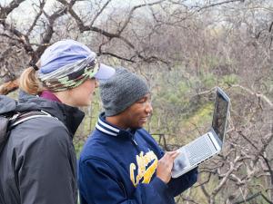
Nina Maggi Kelly is a professor in the Division of Ecosystem Sciences, Environmental Science, Policy & Management, and a Cooperative Extension Specialist based at UC Berkeley. She is an accomplished geospatial data and analysis innovator. She is dedicated to bringing cutting-edge mapping technology, training, and research support to the ANR and UC network of students, staff, faculty, and the public. Her research group uses a range of geospatial analysis approaches using data from numerous sources - spatial models, remote sensing, drones, lidar, historical archives, surveys, participatory mapping, and the field - to gain insights about how and why California landscapes are changing, and what that change means for those who live on, use, and manage our lands. The spatial data science field is evolving quickly, and she actively works to build a community interested in applied geospatial research and outreach locally at UC Berkeley and across the state. She is Faculty Director of the UCB Geospatial Innovation Facility (GIF) and Director of the ANR Statewide Program in Informatics and Geographic Information Systems (IGIS), both of which are dedicated to research, outreach and service in support of applied geospatial data and analysis.
Leadership Roles:
- Faculty Director of the Geospatial Innovation Facility;
- Director, ANR Statewide Program for Informatics and Geographic Information Systems (IGIS);
- Senior Fellow at the Berkeley Institute for Data Sciences (BIDS)
Research Expertise and Interest
remote sensing, drones, ecosystem sciences, forests, geoinformatics, participatory web, GIS
In the News

How Urbanization Shapes Coyote Behavior and Connectivity in LA
New UC Berkeley Center Will Apply Data Science to Solving Environmental Challenges

Warmer, drier climate altering forests statewide
Historical California vegetation data that more than once dodged the dumpster have now proved their true value, documenting that a changing forest structure seen in the Sierra Nevada has actually happened statewide over the past 90 years.

Smartphone users can report sudden oak death
To get a broader perspective on sudden oak death, which has felled hundreds of thousands of California's majestic oaks, UC Berkeley scientists have developed a smartphone app for hikers and other nature lovers to report trees they find that have succumbed to the disease.