Rising seas: A new look at resilient infrastructure
We know that our changing climate will bring rising sea levels to the Bay Area. But do we know how to handle it? Mark Stacey, professor of civil and environmental engineering, has assembled a cross-disciplinary team to find out. The research is part of a National Science Foundation-sponsored initiative examining critical infrastructure resiliency.
“For several years, many have held the belief that the biggest barrier to solving environmental problems lies more on the social side than in the technology or the engineering,” Stacey says. “We’re trying to do a cross-disciplinary analysis.”

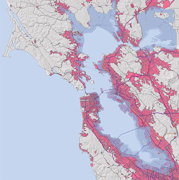
Part of the research will identify potential traffic snarls caused by rising seas and suggest alternatives to future-proof infrastructure that is already strained. The transportation system’s interactions will also be used to shed light on the reactions of the various governmental agencies.
The ultimate goal of the research is to examine how city, regional, state and federal government agencies interact during a time of prolonged environmental stress and find the places where officials and agencies can improve coordinated management of infrastructure and resources.
“We want to quantify the way overlapping jurisdictions engage in piecemeal decision-making and show that in regard to coastal flooding and sea-level rise, the structures of governance systems are mismatched with physical infrastructure — like levees and seawalls and the transportation system,” Stacey says.
Stacey is working with an interdisciplinary team on the research. He is joined by CEE colleague Alexey Pozdnukhov, an urban systems data analytics specialist; Samer Madanat, a former Berkeley transportation professor who is now dean of engineering at NYU in Abu Dhabi; Mark Lubell, a UC Davis political science professor who studies human cooperation in environmental policy; and oceanographer Li Erikson and geologist Patrick Barnard of the U.S. Geological Survey (USGS).
In the first phase of the four-year grant, Stacey is conducting data modeling to determine how sea-level rise, tides and storms will affect regional coastal flooding, while Erikson and Barnard make 100-year flood predictions using a USGS tool. Pozdnukhov is using forecasts for regional sea-level rise and flooding to construct models showing the impacts to the traffic system.
Starting this summer, Lubell will survey a range of governing authorities along the shoreline to determine how decisions affecting coastal flooding policy are made.
Then, using the compiled research data, Madanat will come up with an ideal configuration of the Bay Area transportation system. “He’ll look at the traffic disruptions created in the future and figure out how to best invest in the system to minimize travel cost and travel time,” Stacey says. Madanat’s results will be presented as a series of recommendations on whether to invest more or less in specific infrastructure at the local level.
Over the next four years, while building the technical models and analysis, the team will collaborate with the Climate Readiness Institute, an organization founded at Berkeley that brings together policymakers and industry leaders in discussion with Bay Area climate scientists.
“We’re approaching this as a partnership with the managers and actors who make real decisions about how to prepare for and adapt to rising seas,” Stacey says.
