Wildfire Season Is Here. Scholars Are Helping Communities Prepare.
UC Berkeley Professor Michael Gollner and his students are applying advanced wildfire simulation tools to help neighborhoods understand their specific wildfire risks.
The Berkeley Hills may feature stunning views and easy access to parks and hiking trails, but living so close to California’s fire-prone forests and grasslands is also risky. CalFire’s recently updated hazard maps rate significant portions of the East Bay Hills at “high” or “very high” risk of wildfire, including more than 650 acres of land in Berkeley and 4,590 acres in Oakland.
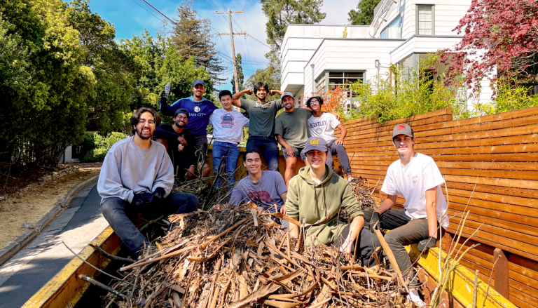
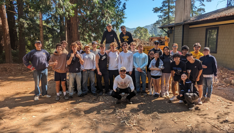
For the past two years, UC Berkeley professor and wildfire expert Michael Gollner has partnered with Berkeley Hills residents to help reduce the risk of severe wildfire in the neighborhoods surrounding the campus. With the support of a Chancellor’s Community Partnership Grant, Gollner applies state-of-the-art wildfire simulation tools to advise the Berkeley FireSafe Council on fuels reduction. At the same time, the Council uses funds from the grant to donate honoraria to Berkeley student service organizations whose members help clear excess brush and vegetation from the area.
“The Council had been trying to engage student groups to help them do fire risk reduction in the community,” Gollner said. “We ended up forming this neat partnership where we were able to do some analysis for them and tie that into our research.”
But the hills surrounding the Berkeley campus are just one of many Bay Area regions facing high risk of wildfire. Last summer, Gollner started hearing from other local community leaders who were looking for guidance, including Richmond City Councilmember Soheila Bana, who is Chair of the Contra Costa FireSafe Council.
In response, Gollner redesigned his wildland fire science course to give students the opportunity to model real-life wildfire scenarios — and help out at-risk Bay Area communities in the process.
“In the class, I teach students about wildfire modeling tools and how we use those tools to design safer communities,” Gollner said. “In the past, I had always created these contrived projects for them to practice using the models. This year I thought, why don’t we just pick real communities?”
Mapping wildfire risk at the hyperlocal level
As a new wildfire season begins, connecting local municipalities and community groups with the cutting-edge fire research happening at Berkeley is more critical than ever. This January’s devastating wildfires around Los Angeles, paired with the state’s ongoing homeowner’s insurance crisis, have many Californians thinking critically about wildfire preparedness, and wondering if hardening their home against wildfire or creating a defensible space zone around their property could lessen their risk. In the city of Berkeley, a new ordinance that bans vegetation within five feet of buildings in the city’s highest fire-risk zone has drawn backlash from many homeowners.
In his research, Gollner creates detailed simulations of wildfires in urban communities to identify how specific factors — including the locations of structures and roads, construction materials used and the proximity of vegetation — increase or decrease a community’s fire risk. His goal is to create a much more granular understanding of wildfire risk than is currently provided in CalFire hazard maps, and show how incorporating specific changes, like fire-safe landscaping or fire-resistant siding, can help keep people safe.
“CalFire maps are meant to highlight areas where you need more fuel clearing or more hardening for new construction,” Gollner said. “What we’re doing in our research is meant to be useful at a more hyperlocal level — identifying how much of a specific block needs to be mitigated or the danger posed by a specific field.”
Gollner’s collaboration with the Berkeley FireSafe Council began after he was approached by two Berkeley Hills residents, Alec and Benay Dara-Abrams, who wanted to incorporate science-based approaches into their work at the Council.
“There is expertise at UC Berkeley and there are people here in the community who need guidance,” said Benay Dara-Abrams. “We thought, ‘Why don’t we put them together?’”
When other Bay Area residents started reaching out with similar requests, Gollner wanted to help, but his research grants weren’t designed to support community outreach at a larger scale. Instead, he decided to integrate real-world projects into his wildland fire science course.
Before the class began, Gollner solicited project proposals from 17 fire-prone neighborhoods in Marin, Contra Costa and Alameda counties. They varied in size from a few hundred to a few thousand households, each facing a unique set of challenges. Some, like the Kennedy Grove Park neighborhood in El Sobrante, are nearly surrounded by the forests and grasslands of the East Bay Hills. Others, like Point Richmond, are home to industrial facilities like the Chevron oil refinery that could spread dangerous contaminants if they were to catch fire.
Working in groups, the students each chose a neighborhood to study and used publicly available wildfire modeling tools like FlamMap to simulate how fire might spread through the community. They then collaborated with community partners to identify concrete steps residents could take to mitigate their risk, such as removing flammable vegetation or adding new evacuation routes.
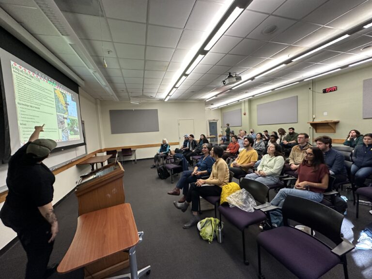
At the end of the course, the students presented their findings and recommendations at a public meeting that was attended by a variety of local community members, including representatives from the Berkeley Fire Department and the Marin Wildfire Prevention Authority.
“The projects were a really nice way to expose the students to what it’s like to work on community risk assessment in the real world,” Gollner said. “It was a really fun process and we’ve maintained connections with a lot of the community groups.”
Soheila Bana, who attended the presentations, said she came away with specific ideas for improving wildfire safety in Richmond, including checking the locations of fire hydrants and signs marking evacuation routes.
“[The students] had a fresh perspective and … brought many major points and minor points to our attention that we had not noticed,” Bana said. “This one class by one professor shows how this type of collaboration can have very tangible results for the community.”
Benefiting communities; bolstering research
Gollner is just one of many researchers on campus who are collaborating with Bay Area organizations to help reduce the region’s wildfire risk. As part of the Smart and Connected Communities project, a team lead by Berkeley engineering professor Kenichi Soga is creating virtual “mini-games” to help communities prepare for wildfire response and evacuation. Since the summer of 2022, UC Berkeley’s Disaster Lab has partnered with the Marin County Fire Department to run the FIRE Foundry, which recruits young adults from underrepresented communities into the fire service and trains them on the latest firefighting technologies. And last December, a team of city planning graduate students published a report detailing how the city of Berkeley could improve emergency vehicle access and evacuation routes in the Berkeley Hills, where a proposal to allow the construction of denser housing has run up against concerns about wildfire risk.
But despite UC Berkeley’s leadership in community-engaged research, finding the funding or institutional support for this type of work is not always easy. Public health professor Emily Ozer is currently leading a campus-wide effort to connect different community-engaged research projects on campus and help build support for researchers to conduct this work at a larger scale.
In the meantime, Gollner says that he plans to continue to integrate real-world projects into future iterations of the class. He also has partnered with the Moore Foundation’s Wildfire Resilience Initiative to bring risk assessments to more communities and collaborated with social scientists in the U.S. Forest Service and the University of North Texas to help Lake and Sonoma county communities improve their wildfire resilience.
“I would love to professionally be able to do some of this for the communities in the Bay Area, too,” Gollner said. “The class is a great way to sneak it in without any other support.”
Related Stories