CITRIS Researchers to Help Northern California Communities Reduce Wildfire Risk With Dynamic Modeling and Serious Games

With $2.5 million from the National Science Foundation, an interdisciplinary, multicampus University of California research team is partnering with agencies and community organizations in the Bay Area to help residents respond to natural disasters more quickly — and more safely.
The 2018 Camp Fire, which killed 85 people and laid waste to more than 240 square miles of Butte County in Northern California, was the deadliest and most destructive wildfire in the state’s history.
Building on a Seed Funding project from the Center for Information Technology Research in the Interest of Society and the Banatao Institute (CITRIS), with significant support from the National Science Foundation (NSF), researchers from the University of California (UC) are taking lessons learned from the Camp Fire and other disasters and applying their expertise in complex systems modeling, risk management and human-computer interaction to mitigate future tragedies in hazard-prone communities.
The NSF has awarded $2.5 million, co-funded by its Smart & Connected Communities and Advancing Informal STEM Learning programs, to a team of engineers, policy scholars and design experts at the UC campuses in Berkeley, Davis and Santa Cruz.
Led by Kenichi Soga, the Donald H. McLaughlin Chair in Mineral Engineering and Chancellor’s Professor at UC Berkeley, the researchers will use the grant over three years to develop an interdisciplinary framework to simulate wildfire evacuation methods in two Bay Area communities — Marin County and the city of Oakland in Alameda County — and to educate community members on how to escape wildfires safely.
The researchers will collaborate with 12 partner agencies, including Fire Safe Marin and the Marin Wildfire Protection Authority (MWPA) in Marin County, and the Diablo Firesafe Council, East Bay Municipal Utility District (EBMUD), Oakland Fire Department, Oakland Firesafe Council, North Hills Community Association, Lawrence Berkeley National Laboratory (Berkeley Lab) Fire Department and Port of Oakland in Alameda County. The California Department of Technology and Sunnyvale Fire Department will also participate, as will the Insurance Institute for Business & Home Safety, an independent, nonprofit research organization supported by property insurers, reinsurers and affiliated companies.
When we got the CITRIS grant, I knew we were exploring something meaningful. It’s thrilling that we’re addressing this important idea at a much larger scale.
THOMAS MAIORANA, ASSISTANT PROFESSOR OF DESIGN, UC DAVIS
The project’s framework involves two primary tools: a layered virtual model of physical infrastructure, communications networks and emergency services, called a “digital twin,” to simulate how each municipality might react to a fire, and an interactive digital learning experience, or serious game, for fire management professionals, community stakeholders and regular citizens to use to prepare to take action.
“We need to think about the interactions of decision-making, communications between organizations and the public, and traffic patterns during a wildfire so we can understand what the issues are and how we can improve evacuations in the future,” said Soga, who also serves as the director of the UC Berkeley Center for Smart Infrastructure, a CITRIS principal investigator (PI) and a faculty scientist at the Lawrence Berkeley National Laboratory.
One of the project’s underlying goals is to help shift people’s perspectives from reacting to extreme events when they occur, to instead anticipating emergencies and looking for ways to reduce risk before disaster strikes.
Assembling multidisciplinary expertise
Joining Soga on the project are UC Berkeley colleagues Louise Comfort, professor emerita, fellow CITRIS PI and former director of the University of Pittsburgh Center for Disaster Management; Stephen Collier, professor of city and regional planning; J. Keith Gilless, professor emeritus of forest economics; and Michael Gollner, associate professor of mechanical engineering.
Cross-campus collaborators include three faculty members from the UC Santa Cruz Department of Computational Media, all of whom are also CITRIS PIs: professor and Jack Baskin Endowed Chair in Engineering Katherine Isbister, assistant professor and Vice Chair of Serious Games Edward Melcer, and professor and department Chair Magy Seif El-Nasr. CITRIS PI and UC Davis assistant professor of design Thomas Maiorana will also play a key role.

Maiorana, Soga and Comfort previously joined forces on the 2019 CITRIS Seed Award project that catalyzed the current work.
“When we got the CITRIS grant, I knew we were exploring something interesting and meaningful,” said Maiorana. “It’s thrilling to me that we’re addressing this important idea at a much larger scale.”
The interdisciplinary work facilitated by the Seed Funding program is core to CITRIS’s mission to create information technology solutions for society’s greatest challenges.
CITRIS helped to bring together capability across the UC system, which should have great practical benefit to Californians.
KATHERINE ISBISTER, PROFESSOR AND JACK BASKIN ENDOWED CHAIR IN ENGINEERING, UC SANTA CRUZ
“The CITRIS network really strengthened what came together,” Isbister said. “The core team Dr. Soga formed did fantastic foundational work.
“CITRIS helped to bring together capability across the UC system, which should have great practical benefit to Californians.”
Learning lessons from tragedy to build resilience
In the wake of the Camp Fire, a group of UC Berkeley researchers that included Soga and Comfort traveled to the town of Paradise — more than 95 percent destroyed by the blaze — with the support of an NSF Quick Response Research grant through the University of Colorado Boulder. Soga, a civil engineer with a deep interest in smart infrastructure and city-scale simulation, and Comfort, a public policy scholar with more than 30 years of experience in crisis decision-making research, sought to explore what factors may have contributed to the extreme devastation.
Due to its location on the wildland-urban interface (WUI), an area of transition between unoccupied wilderness and human settlement, Paradise was already at heightened risk.
After interviewing emergency responders and town officials, the researchers identified several issues that compounded the tragedy: a lack of communication between Paradise and nearby Chico that kept traffic signals from changing to accommodate for increased traffic on the evacuation route, a loss of cell phone service that kept evacuees from accessing timely info, and the unprecedented speed of the wildfire itself making a staged evacuation impossible.

The next year, the town of Bolinas reached out to Comfort, then serving as a visiting scholar with the CITRIS Policy Lab, to discuss whether the research team could help develop its wildfire evacuation plan. Bolinas, an unincorporated area in Marin County with a population under 2,000, shared several risk factors with Paradise, including its demographics, difficult ingress and egress, limited resources, and location on the wildland-urban interface.
Its much smaller size, and order of magnitude fewer residents than pre-fire Paradise, also made Bolinas a promising prospect for detailed modeling and community engagement.
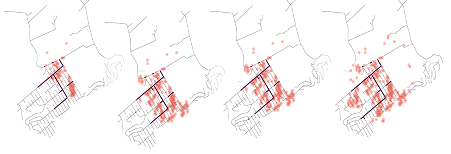
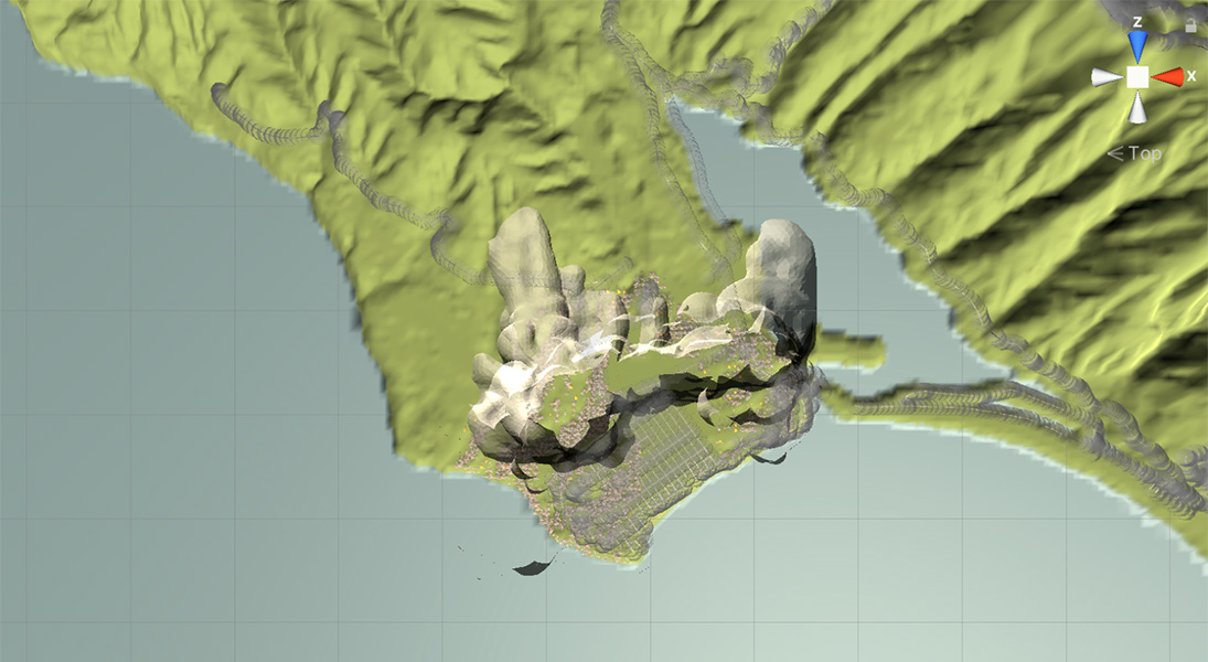
The UC Institute of Transportation Studies (ITS) supported the team’s robust simulation work, which integrates fire progression, traffic patterns, communication processes and details about the systems that manage them. This sociotechnical digital twin, notable for incorporating data about communication networks and organizational structures, shows the flow of information to identify where failures in technical systems — like cell phone towers damaged by wildfire — will cascade down to the organizations that depend on them to keep people safe.
Maiorana, a designer and artist with an interest in the intersection of prototyping and policy, added yet another layer to the project after a conversation with Comfort. He, Soga and Comfort applied for a 2019 CITRIS Seed Award with the aims of funding further modeling and addressing an important yet extraordinarily challenging aspect of disaster preparedness: educating the public.
With CITRIS’s support, the researchers held workshops with the Bolinas Fire Protection District and designed, with community input, a board game that replicated the evacuation experience, complete with wildcards.

Word spread about their work, and fire departments and community-led councils in Marin County and Oakland reached out to see if the team could apply the technology to their own jurisdictions. With more organizations and municipalities at play, the team grew to involve more researchers across UC Berkeley and UC Santa Cruz.
“I was immediately interested in the project,” said Isbister, director of the UC Santa Cruz Social Emotional Technology Lab, which designs and studies serious games that enhance physical, social and emotional experiences. “It’s such a timely issue and an innovative approach to helping communities build resilience around wildfires.”
The opportunity for impact increased with the expanding expertise, including anthropology and city planning, forest management, fire science and combustion, embodied computational learning, and alternate reality games.
“As the team started to grow, so did the potential for what we could do at the intersection of community, fire and policy,” said Maiorana.
Using a simulated city to shift perspectives
The NSF-awarded project has a number of interdisciplinary goals, spanning the range of the researchers’ areas of expertise: identifying the individuals and organizations most pertinent to wildfire evacuation, expanding the digital twin to include the greater Bay Area, creating serious games for fire safety councils to share with their constituents, and proposing long-term policy recommendations to improve responses to future natural disasters.
Comfort and Isbister will lead the charge in determining the local organizations most responsible for wildfire mitigation, as well as community groups likely to serve as primary communicators during disasters. Their team will then select a representative sample of these stakeholders, ranging from fire departments to neighborhood watch groups, to explore their risk awareness and to collect their feedback on the serious games.

Comfort will also work with Collier to map the relationships between state authorities, utility companies, and social and cultural institutions such as schools, hospitals and banks. They plan to assess a subset of organizational procedures regarding wildfire plans for any changes made since 2017, which they’ll then use to forecast changes for 2022–26.
“Once roads and bridges are built, they’re fixed,” Comfort said. “What we can change is how people learn, which depends on their access to valid information in a short time period during an emergency response.
“If we can build the knowledge base and educate the managers ahead of time, they can use the technology that is available to them much more accurately and quickly.”
Soga, alongside Gollner and Gilless, will further work on the digital twin. Having completed the Bolinas model, the team will expand the simulation to include the full breadth of Marin County, before turning their attention to Oakland and the greater Bay Area.
“In our simulation, we model individual cars and how they move through the streets to evacuate to a safe place,” Soga said. “If there is suddenly a wildfire in Marin County, how do people evacuate with the background traffic coming from San Francisco and other locations during the daytime?”
This element of the project has already made progress toward commercialization. Soga, together with members of his lab group and other collaborators, have founded a startup called WUI-GO! to take their evacuation planning tool — intended to help fire agencies assist vulnerable populations in creating emergency preparedness plans — to market.
The company was part of the spring 2021 CITRIS Foundry incubator cohort, and then received a 2022 NSF Innovation Corps (I-Corps) award. The founders plan to pursue Small Business Innovation Research (SBIR) funding to help them develop the market for their low-cost, interactive platform.
A crisis situation is more than an intellectual exercise; it’s an emotional response. As we get better at dealing with these crises, it’s important that we have practiced responding with our emotions.
THOMAS MAIORANA, ASSISTANT PROFESSOR OF DESIGN, UC DAVIS
As the project proceeds, Isbister, Maiorana, Melcer and Seif El-Nasr will take the information about communications networks and data from the digital twin to create two web-based serious games to help stakeholders and citizens. The researchers will be advised by an outside expert, Raph Koster, a commercial game designer and entrepreneur well known for his contributions to Ultima Online, an award-winning massively multiplayer online role-playing game (MMORPG).
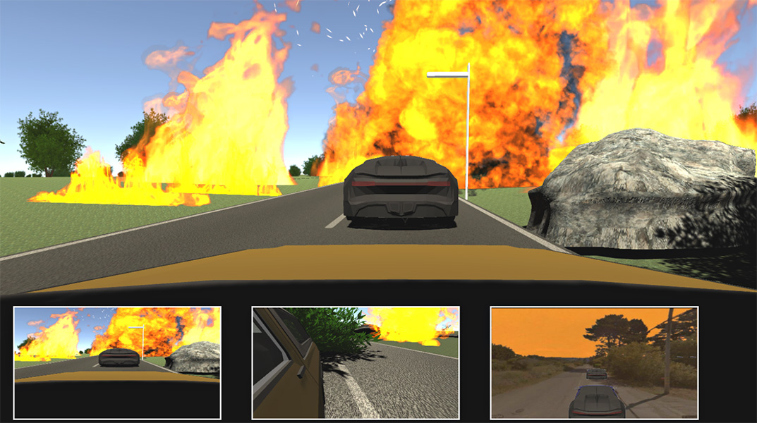
Their first game will take Maiorana’s previous work on evacuation exercises into the digital realm, while the second will address long-term risk management activities for the community, such as fire-hardening residential buildings or even rezoning neighborhoods.
“Serious games connect to a visceral experience,” Maiorana said. “Suddenly, I’m a little nervous, competitive — I’m engaged in a way that makes the experience more real for me, as a player.
“A crisis situation is far more than an intellectual exercise; it’s an emotional response. As we’re trying to get better at dealing with these crises, it’s important that we have practiced responding with our emotions.”
Maiorana will also lend his prototyping expertise across teams where applicable. In addition, he will design a community event aimed at sparking conversations and facilitating connections among different groups.

Collier and Gollner will lead long-term planning efforts, taking the data gathered throughout the project to create a picture of how communities could create effective plans for wildfire resilience, making use of the simulation and training tools that the team has developed, for the next 20–50 years. Their analysis will also examine how broader policy changes — such as shifts in insurance regulations and pricing — could affect the decisions made by stakeholders at the local scale.
“This project takes a systems view of building sustainable, resilient communities that are resistant to wildfires,” Comfort said. “If we can do this for wildfire prevention, we can apply these same technologies to other hazards Californians are facing, like earthquakes, sea level rise and larger problems brought about by climate change.”
Top images, from left: 1) courtesy of Paola Lorusso; 2) courtesy of Yanglan Wang; and 3) courtesy of Thomas Maiorana
Posted in CITRIS, CITRIS Seed Funding, UC Berkeley, UC Davis, UC Santa Cruz
