Can California fix the Delta before disaster strikes?
When visiting Sherman Island in the Sacramento-San Joaquin River Delta, it is easy to forget the region's ever-present threat of catastrophic floods and instead revel in the West Coast's largest estuary, which supports farmers, anglers, and more than 700 native species of plants and animals, including some that are endangered.
"You drive out there and you see that cows are grazing, birds are chirping; but it's deceptive," said Robert Bea, professor of civil and environmental engineering at the University of California, Berkeley. "As you start to dig in, you find out how incredibly complex and vulnerable we've made this place."
At least 220 government agencies have jurisdiction in the Delta, which is home to half a million residents in 25 villages, towns and cities, including Sacramento, Stockton and Pittsburg. The region is under continual threat from floods, prevented only by a vast - and fragile - network of earthen levees.
Sherman Island, said Bea, is an example of a critical chokepoint in the Delta for the tangled networks of highways, railroads, and electrical, gas and telecommunication lines that serve as lifelines for the San Francisco Bay Area and large swaths of the state. The Delta also serves as the hub for aqueducts that channel drinking water for two-thirds of the state's population - more than 23 million people - and irrigation water for 3 million acres of agriculture responsible for half the nation's fruits and vegetables and one-quarter of its dairy products.
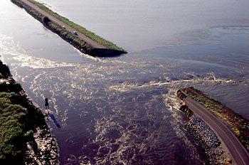
Finding ways to better manage the overlapping agencies is the goal of a four-year, $2 million project headed by Bea and funded by the National Science Foundation. The project, called Resilient and Sustainable Infrastructures (RESIN), brings together 20 researchers in disciplines ranging from engineering to law to organizational behavior (a full list of researchers is online). The team also includes experts from the Natural Hazards Center at the University of Colorado at Boulder.
Bea and other investigators on the RESIN team are among a significant number of UC Berkeley researchers who are using their expertise to tackle the extraordinary challenges of the Delta. In addition to the team members on the RESIN project, which is in its early stages, there are UC Berkeley researchers in urban planning, law, policy and biometeorology who also are studying the unique problems of the Delta region.
The stakes are clear if solutions are not found:
- A 2002 U.S. Army Corps of Engineers study predicted a 99 percent chance of flooding within the next 50 years on 13 Delta islands.
- A 2006 California Department of Water Resources study projected that a one-foot rise in sea level - a mid-range prediction from the Intergovernmental Panel on Climate Change - would increase the frequency of a 100-year peak tide to a 10-year event.
- There have been more than 160 levee failures in the Delta over the past century, according to the water resources department.
- What many experts fear most is a significant earthquake of magnitude 6.5 or higher from the Hayward Fault, or from any of the other smaller faults in the San Andreas zone, that could trigger multiple, widespread and simultaneous levee breaches. Such massive levee failures could result in the loss to California's economy of $30-40 billion, according to state estimates.
The ultimate Gordian knot
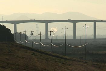
The damage from a large quake would reach far beyond the life and well-being of the Delta's residents or its ecosystem. The force of the water flow from massive levee breaches would suck ocean water into the Delta, contaminating the fresh water supply relied upon by tens of millions of Californians and sending ripple effects across the nation, said Ray Seed, UC Berkeley professor of civil and environmental engineering and one of the country's leading experts on the Delta.
Such flooding would set off a chain reaction of failures in the adjoining infrastructure systems that would have ripple effects throughout the state, experts said.
"If, in fact, we lost power here, that power would affect our ability to pump natural gas," said Don Boland, executive director of the California Utilities Emergency Association, motioning to a pump station not far from Highway 160 in the northern part of Sherman Island. "It's going to affect our ability to power our water systems, our pumping stations, and our lift stations."
The loss of telecommunication monitoring systems would impact the energy transmission through the gas lines, Boland added, "so everybody is in this together. No one utility can stand alone."
A workable solution to this threat has eluded California for decades as the fishing community and environmentalists fight to maintain water flows for Delta smelt and Chinook salmon, while thirsty water users further south battle to keep their crops irrigated and residents supplied.
"The Delta's problems are massively complex at a technical level, but it's all overlaid by politics," said Seed. "It's about the guys who want water versus those who protect the fish, but the guys doing the fighting aren't even worried about the seismic risk."
"It's the ultimate Gordian knot," said Seed. "There is no other system in the world as complex as the Delta."
From marshland to farmland
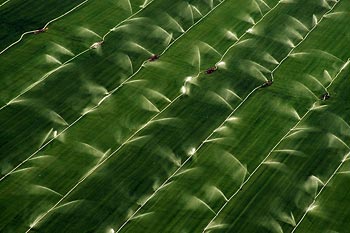
For millennia, the Delta was a tidal marshland where rivers from the Sierra Nevada are funneled out into the Pacific Ocean. The Delta was primarily home to Native Americans for centuries. In the mid-1800s, the California Gold Rush drew in waves of settlers eager to lay claim to the land's riches. Many of the Delta's earliest towns were formed during this time.
The Delta makes for attractive farmland - when it is not underwater - as the soil is rich with peat nourished by decaying vegetation, including the native tule reeds. The first crude levees of the region were hand-built by Chinese laborers and private landowners in the mid-1800s, and they predictably succumbed to flooding on a regular basis. Better technology in the form of steam-powered clamshell dredges led to the construction of more substantial levees, accelerating the pace of reclamation in the late-1800s.
By the 1930s, what was once a tidal marshland had been transformed into half a million acres of agricultural land in a man-made archipelago of some five dozen islands.
Renewed attention was given to levee construction in the '30s when the decision was made to export Delta water to the Central Valley and Southern California. The U.S. Army Corps of Engineers began upgrading "project" levees with funding from the federal government. By 1940, the export of Delta water began as part of the federal Central Valley Project. Water transfers increased decades later with the passage of the State Water Project.
The construction of dams and reservoirs followed, water diversions grew, and the Delta's fish population took a dive, setting the stage for California's contentious and ongoing water wars.
The incredible sinking Delta
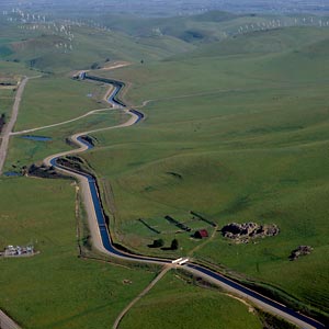
Today there are more than 1,100 miles of levees - longer than California's coastline - surrounding 837,000 acres of land in the Delta and Suisun Marsh. Many of those levees are now a century old.
The peat proved to be fertile ground for farms, but its exposure to oxygen and compaction literally sank the land as microbes gained access to the organic debris through the drainage of water. The land continues to sink at a rate of 1-3 inches per year.
Like most of the islands in the Delta, the land on Sherman Island sits 15-20 feet below sea level, a result of decades of subsidence.
Few know this better than biometeorologist Dennis Baldocchi, a UC Berkeley professor in the Department of Environmental Science, Policy, & Management. Baldocchi came from a family of Delta farmers, starting with his grandparents who settled in Antioch after emigrating from Italy. Baldocchi's father grew almonds and walnuts in the Delta towns of Antioch and Oakley, while several aunts, uncles and cousins farmed asparagus, sugar beets, grains and other crops on Liberty and Sherman islands over the decades.
One of Baldocchi's aunts had fortunately moved out of her home on Sherman Island right before it was destroyed in a 1969 flood that resulted from a levee break. The home was never rebuilt, but Baldocchi's connection to the region remains. As a researcher, he has been studying the release of greenhouse gases in the Delta as methane and carbon dioxide are released from the peat.
When Baldocchi returns to Sherman Island for his research, he sees a landscape changed from his childhood memories.
"What strikes me most is the visual impression I get standing on a road today and seeing how much lower the fields are - 3 to 4 feet in many cases - from where they were 30 years ago when I was tramping through the fields pheasant hunting with my dad," said Baldocchi. "I can even see the markings on telephone poles from where the soil used to be. Those footings on the utility poles were probably buried in the peat when they were originally installed 70 to 80 years ago."
Exacerbating the vulnerability of the region is the continued development and population growth of the Delta. A 2007 report initiated by UC Berkeley's Department of Landscape Architecture and Environmental Planning noted that high housing prices throughout Northern California contributed to growth pressure in Delta communities. The report's authors noted that since the 2000 census, the towns and cities within the Delta have grown by 18 percent, with some, including Brentwood, Tracy and West Sacramento, experiencing growth of 25 percent.
A Delta Vision
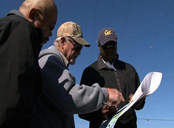
The RESIN project expects to develop new risk assessment tools to better evaluate and manage these various threats to the Delta's resilience and sustainability.
"The issues of the Delta go far beyond an engineering problem," said policy analyst Emery Roe, an associate with UC Berkeley's Center for Catastrophic Risk Management and one of the lead researchers on the RESIN team. "If we only think about the levees, we've lost sight of the bigger challenge of all these various infrastructure systems managed together."
"The problems we see in the Delta are the same ones we saw in New Orleans," said Bea, who was part of the research team led by Seed that was deployed in 2005 to investigate the New Orleans levee failures in the wake of Hurricane Katrina. "We have the fundamental knowledge about how to approach these issues, but we haven't mobilized the collective will to address them."
Hurricane Katrina provided a jolt to California that is resulting in growing efforts, like RESIN, to tackle the challenges presented by the Delta. In 2006, in an effort to find and implement a long-term fix, Gov. Arnold Schwarzenegger began the Delta Vision project. He formed a Blue Ribbon Task Force on the Delta and charged the group with creating a "durable vision for sustainable management of the Delta."
The seven-member task force was chaired by Phil Isenberg, former Sacramento mayor and a graduate of UC Berkeley School of Law. Its members also included two UC Berkeley faculty members: Seed and Richard Frank, executive director of the School of Law's Center for Law, Energy and the Environment.
The task force released a strategic plan in 2008 that emphasized the need to treat protection of the ecosystem and the state's water supply as primary, co-equal goals for sustainable management of the Delta.
"In 2009, after a protracted legislative debate, we got a package of five bills. I was pleasantly surprised that those bills touched on much of what the task force recommended," said Frank. "It's far from perfect; some of our strongest recommendations were not fully embraced, but it's a step forward."
The package of bills is meant to provide for stricter groundwater monitoring and enforcement of illegal diversions, a more ambitious water conservation policy, and water recycling and conservation programs.
The state's water package also created the Delta Stewardship Council in response to the task force recommendation for a central, overarching authority to which Delta stakeholders can turn. The council had its first meeting on April 1. Isenberg, who had headed the task force, was elected chair of the council for four years. The council is charged with developing a comprehensive plan for the Delta by the end of 2011.
Cynicism exists about whether the council can effectively tame the competing interests in the Delta, but task force members say it's a start. "The pre-existing situation is that there were more than 200 government agencies in the Delta, and no one was in charge," said Frank.
"We've had a 60-70 year stalemate," said Seed, who also is an advisor on the RESIN project. "The biggest change now is the conjugate level of desperation from all parties. No one is winning, and people are finally realizing that if we all keep fighting each other, we eventually will all lose together."
Delta Links:
RESIN Home Page
Delta Vision Website, with links to the Blue Ribbon Task Force reports
Delta Stewardship Council
The Delta Initiative: Re-envisioning the Heart of California
