$1.5 million grant will improve wildfire spotting from the air and space

California’s fire season is in full swing and could well be worse than in 2020, but new tools are on the way to help responders more rapidly locate wildfires once they break out and, ideally, quickly extinguish them before they get out of control.
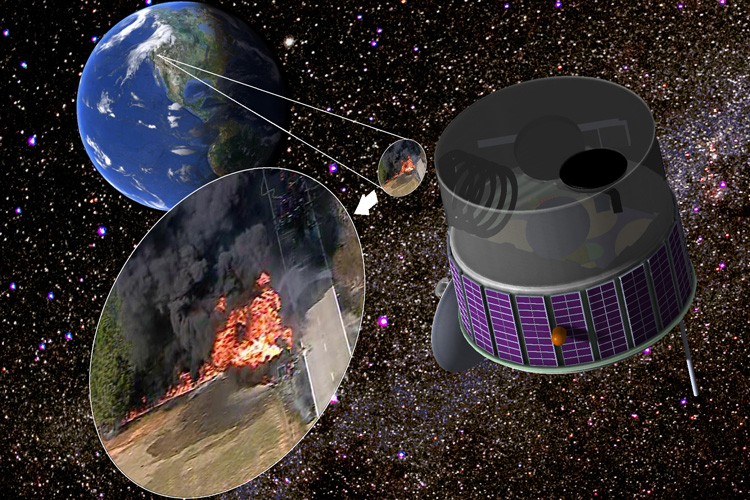
With the help of a $1.5 million grant from the Gordon and Betty Moore Foundation, a University of California, Berkeley, physicist and a firefighter-turned-scientist plan to outfit spotter planes with improved infrared detectors to learn more about how fires spread. And within four years, they hope to send similar systems into space for 24/7 fire discovery and monitoring.
Real-time airborne infrared data, combined with machine learning algorithms that can map hot spots in thermal images within milliseconds, will help them create “fire behavior” maps for firefighters within 20 minutes of an outbreak. The detectors can also provide information on flame length and geometry that, combined with wind speed and humidity data, could be modeled to predict where and how fast a fire will spread.
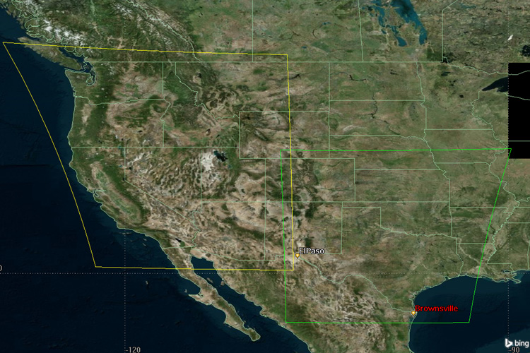
The airborne detectors will provide a proof-of-concept toward achieving the team’s ultimate goal, which is to design an instrument package that would sit on geostationary satellites and continuously look for fire outbreaks over the Western U.S. or other fire-prone areas around the world.
“We plan to build a system that really delivers a better, more detailed spatial characterization of fires to firefighters in real time,” said Tim Ball, a former professor at the University of Nevada, Reno, and founder and president of Fireball Information Technologies LLC, a Reno-based fire assessment and mapping company with operations throughout the Western U.S. “This will also improve our predictive models to a degree that improves firefighter safety and the tactical and strategic decision making on the ground.”
“One study estimated that if you can just discover and get to a fire earlier, you would save $8 billion dollars over a decade,” said Carl Pennypacker, a physicist at UC Berkeley’s Space Sciences Laboratory (SSL) and co-principal investigator with Ball on the grant. “If firefighters could be alerted to a fire within 10 minutes — if they knew where it was and could get to it, even without any heroic measures, like airborne tankers on constant alert — that saves a lot of money and lives.”

Pennypacker first proposed such a satellite-borne fire spotter more than seven years ago, to be called the Fire Urgency Estimator on Geosynchronous Orbit (FUEGO). Since then, he has lowered his sights a bit, he said, looking also at airborne surveillance and hooking up with the ALERTWildfire group at UC San Diego (UCSD) that maintains a network of near infrared cameras around the state for early confirmation and potential suppression of incipient wildfires.
In the past few years, Pennypacker also connected with Ball, who started Fireball 20 years ago in an attempt to better predict how fires will spread and has connections with Cal Fire, California’s firefighting unit; the National Forest Service, which flies its own fire-spotting planes; and firefighting teams on several continents. The two teamed up with engineers at SSL — a laboratory that has built more than 100 instrument packages for satellite missions over the past 60 years — to design and build the detector systems.
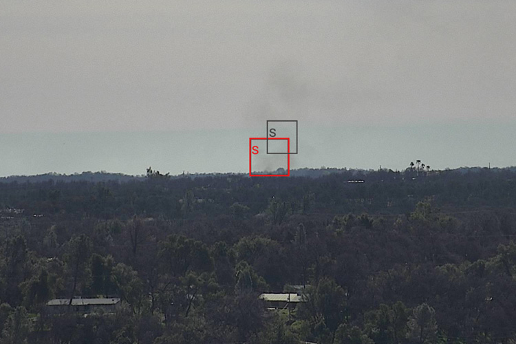
Pennypacker’s expertise is in analysis software: He was a co-founder of the 2011 Nobel Prize-winning team that in 1998 analyzed light from supernovas to discover dark energy. He and Ball now work with UCSD’s ALERTWildfire and HPWREN (High Performance Wireless Research and Education Network), pioneers in early fire-camera technology and the Internet provider that connects the so-called pan, tilt, zoom (PTZ) near-infrared cameras, to analyze the images to confirm fires between 1 and 5 minutes after ignition.
Pennypacker said that he and Ball’s experience with firefighters leads them to believe “that the information is changing the culture of fire agencies. Because they can understand the challenge of particular fires faster and more thoroughly, they can respond in more effective ways.”
Changing fire regime
“It is not unusual for wildfires to burn for 20 minutes or more before being reported, by which time they can be beyond easy control,” Ball said. The 2018 Camp Fire that destroyed the community of Paradise in Northern California was beyond control before any fire crews could reach the point of ignition. It ultimately burned 340 square miles, took 85 lives and cost more than $24 billion in losses and fire suppression costs. In 2018 alone, California wildfires caused economic losses of nearly $150 billion, according to a UC Irvine study.

“The actual number of fires is down from the 20-year average, but the intensity is up, the size is way up,” Ball said. “Although we have fewer fires, they burn a lot more acres.”
Climate change caused by burning of fossil fuels, Pennypacker said, is one of the major culprits.
“There are many ways in which climate change is impacting fires now: The number of drought years has been high in the last three decades. Warmer temperatures and drought extend the fire season. Higher temperatures reduce the relative humidity, causing especially fine fuels to be drier and more easily ignited. This is especially pronounced at night — fires used to die at night, but now they keep roaring. There are more strong wind events, which both fan flames to higher intensity and carry the resulting embers farther. When the fire-thrown embers land in the drier fine fuels, spot fires erupt carrying fires forward at a much faster speed than just a normal flame front — sometimes up to tens of miles an hour,” he said.
While the tools for fighting fire have improved a great deal — bigger, better aircraft; more agile fire engines; better firefighter training — Ball said it is evident that we are falling behind the increase in fire destructiveness. Areas that have lagged significantly are persistent, real-time intelligence and predictive understanding of fire spread. These would help firefighters stay a step ahead, rather trying to catch up with the way that fires are changing, he said.
While a handful of companies in the Western U.S., including Fireball, offer assistance — fire-spotting planes, helicopters and drones, as well as modeling software to predict a fire’s movement — Cal Fire, for the most, part relies on planes flown once daily by the U.S. Forest Service and flown only at night, because the standard detectors are unable to handle the enormous dynamic range of infrared radiation required to characterize active fires.
“That is what is different about what we are doing,” Ball said. “We can measure tiny spot fires and huge flame fronts, then deliver maps depicting flame size, intensity — energy release — and rates of spread to firefighters on the ground just minutes later. These fire characteristics are, at the same time, what firefighters need to know for tactical and strategic decision-making and what predictive models need to project future fire conditions.”
Similarly, the UC Berkeley Fuego Group’s geosynchronous satellite payload will fill an unmet need on the basis of solid, cross-disciplinary understanding. Pennypacker says:
“Our satellite design benefits not only from recent advances in infrared imaging, but also from careful study of signal background and considering how best to recognize small fire signals in that background, as well as optimizing the trade-off between spatial resolution and time to detect/report a fire,” Pennypacker said. “The result is that we can scan the entire fire-prone Western U.S. many times per minute and process the sequence to detect fires of about the same footprint as two semi-trailers. This is a breakthrough in fire detection capability.”
Pennypacker and Ball emphasized that the airborne system will play the important role of cross-checking the calculations of small signal detectability and other aspects of calibration for the geostationary instruments.
“The airplane system can measure signal strengths and backgrounds and test data flows and analysis software,” Pennypacker said. “Thus, when we launch the satellite in a few years, we will be flying a well-tested and proven system.”
