Rising Groundwater Threatens Thousands of Toxic Sites in the Bay Area
As climate change brings devastating storms and rising tides to California, many coastal communities face another threat, one that’s hidden and trickling up from below.
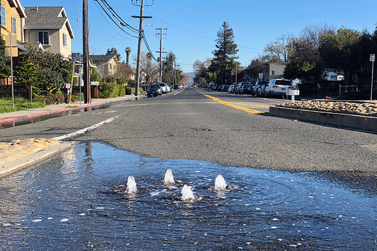
When sea levels rise, dense saltwater moves inland beneath the soil, pushing up the layer of fresh groundwater that floats above it. In many coastal areas, even a few inches of sea level rise can raise the groundwater table enough to flood basements, leak through cracks in sewer lines and disrupt underground infrastructure.
It can also seep into toxic sites from below, mobilizing hazardous materials and spreading pollutants far beyond the limits of the original contamination.
A new report finds that over the next century, rising groundwater levels in the San Francisco Bay Area could impact twice as much land area as coastal flooding alone, putting more than 5,200 state- and federally-managed contaminated sites at risk. Many of these sites are near communities already burdened with high levels of pollution, including West Oakland, the waterfront in Richmond and Hunter’s Point in San Francisco.
“All of these sites need to be reevaluated because it’s not clear that people are safe, and with each passing year, there is more risk,” said study lead author Kristina Hill, associate professor of landscape architecture and environmental planning at the University of California, Berkeley. “We really need to reevaluate these sites in relation to rising groundwater because the remediation strategies and management plans didn’t consider this threat in the past.”
While other studies have identified toxic sites at risk of coastal flooding, this is the first study to look comprehensively at where groundwater rise may mobilize contaminants, and it found more than 10 times as many potentially at-risk sites in the Bay Area than did previous studies. And, these at-risk sites are disproportionately near low-income communities and communities of color, adding to the environmental injustices already faced in these neighborhoods.
Nationwide, the study identified a total of 326 contaminated sites on the U.S. Environmental Protection Agency’s National Priorities List — also known as Superfund sites — that may be vulnerable to rising groundwater.
“We’re really just scratching the surface of what could be happening nationally because there are many, many more sites that are monitored by state or even city agencies that are not being captured here,” said study co-author Daniella Hirschfeld, an assistant professor of landscape architecture and environmental planning at Utah State University.
In the Bay Area, state-managed at-risk sites outnumber at-risk Superfund sites by more than 350 to 1. If this ratio holds nationally, the researchers estimate that the number of at-risk sites across the U.S. could be approximately 115,000. And, these state-managed sites are not necessarily any less contaminated than Superfund sites, the researchers say.
The study is currently undergoing peer review, and a pre-print is available on the Earth and Space Science Open Archive. The researchers hope the findings will spur state and local agencies to take a closer look at at-risk sites to identify those that pose the most urgent need for further remediation.
“We’ve paid a lot of attention in the past years to rising sea level but haven’t necessarily been as aware of the threat from below,” said study author Caroline Lindquist, who recently completed a master’s degree in landscape architecture and environmental planning at UC Berkeley. “Our intent with this study is really to sound the alarms.”
Legacies of contamination
Toxic sites include everything from former military bases and chemical factories to gas stations and dry cleaners. Leaks and spills from these industries can contaminate the soil with a variety of hazards, including heavy metals, volatile organic chemicals, pesticides and herbicides, and radioisotopes.
Excavating a site to remove toxins can be very costly. Instead, contaminated sites are often remediated by adding a “cap” of low-permeability material that protects the tainted soil from rainwater and, ideally, keeps the hazardous material dry and immobilized.
“The capping approach might be helpful if sea level rise is inundating a site from above, but it doesn’t consider the issue of rising groundwater mobilizing contaminants from below,” Lindquist said. “If those contaminants are mobilized, the scary thing is that rising groundwater could also then spread them into underground infrastructure.”
One likely scenario, the researchers said, is that rising groundwater could mobilize volatile organic compounds buried underground, carrying them into nearby neighborhoods where they could seep into cracked sewer pipes. Because these compounds evaporate easily, they could then travel up through drain systems in gaseous form, entering and contaminating indoor air in homes, workplaces and schools.
In 2020, a plume of trichlorethylene (TCE), a chemical linked to liver damage and increased cancer risk, was discovered in the groundwater beneath West Oakland’s McClymonds High School, forcing the school to shut down until regulators could prove that the chemical had not infiltrated the school’s air supply. While the source of the groundwater contamination was never traced, the school is located near industries that use TCE as a solvent.
Rising groundwater levels could spread similar plumes beneath other Bay Area neighborhoods, Hill said.
“When you’re exposed to these kinds of chemicals during a developmental stage, like adolescence or during pregnancy, those are some of the most dangerous times,” Hill said. “So, they really need to look at how plumes may be moving in under and around McClymonds High School and other places where people live and work.”
Some California regulators have already started to recognize the growing danger. The San Francisco Bay Area Water Board now requires people who operate landfills to consider the possibility that groundwater could rise up underneath these facilities. The California Department of Toxic Substances Control has also issued draft guidance mandating that those who monitor contaminated sites must consider potential dangers from rising groundwater.
“With each step, we’ve seen people grasping how important this issue is and beginning to change the rules,” Hill said.
Mapping the risk
Groundwater can move in unpredictable ways, especially in urban settings where building foundations, compacted roadbeds or sewer drains can interfere with underground flows. In addition, many neighborhoods in the Bay Area and other coastal cities are built on artificial fill, a mixture of soil, rocks and rubble that can confound efforts to model groundwater behavior.
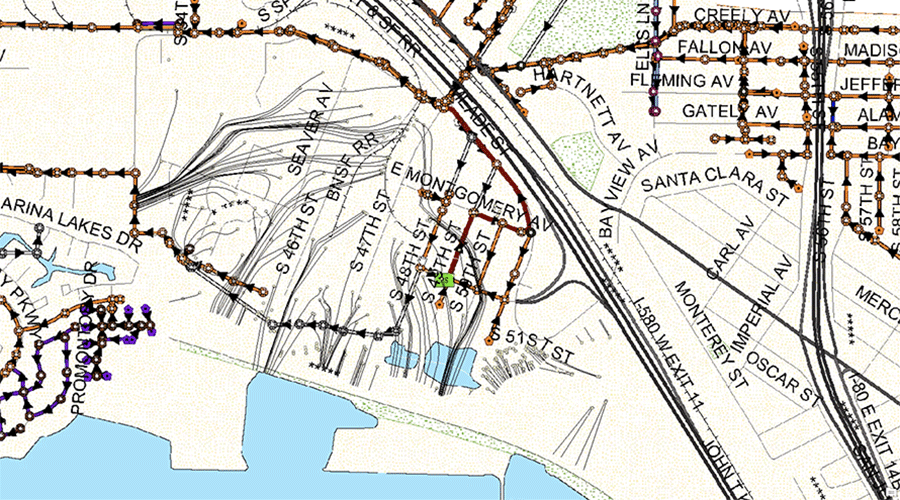
Earlier this year, Hill and collaborators at the Pathways Climate Institute and the San Francisco Estuary Institute published a report and a series of searchable maps highlighting Bay Area regions that face the highest risk of flooding due to rising groundwater. These maps were based in part on a 2019 analysis led by Hill of more than 11,000 measurements of groundwater levels in the Bay Area.
“The measurements showed us all the places where weird stuff is happening that models wouldn’t predict, such as finding extra high groundwater levels on the uphill side of a compacted roadbed, or places where groundwater is surprisingly low because a leaking sewer pipe is allowing groundwater to drain away,” Hill said.
These and other comprehensive forecasts of future groundwater levels along the California coast allowed Hill and the team to pinpoint contaminated sites in the Bay Area that may be at risk. However, detailed predictions of future groundwater rise aren’t available for most U.S. coastal cities. To conduct the nationwide analysis, the researchers searched for Superfund sites located 10 meters or less above sea level.
“Rather than, say, looking for sites located three miles inland from the coast, we looked for sites located 10 meters above current mean sea level, with the assumption that anything that fits into that category would likely have changes in rising groundwater,” said Hirschfeld, who led the nationwide analysis. “Considering the very heterogeneous environments in coastal settings, we thought that looking at elevation would be one way to do a really, really big analysis all across the U.S.”
Rather than retreating from the coast, cities can be redesigned to exist alongside rising seas, Hill said. New forms of architecture and urban design, such as districts of floating houses, could allow cities to adapt to changing tides. Such districts are already being constructed in the famously flood-prone Netherlands.
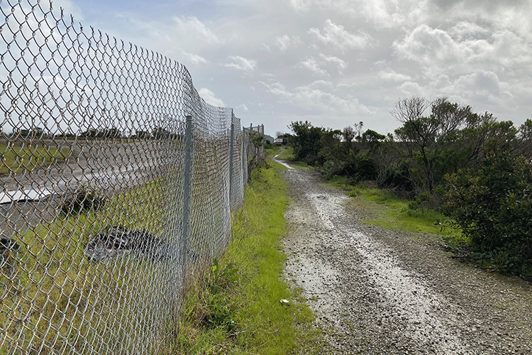
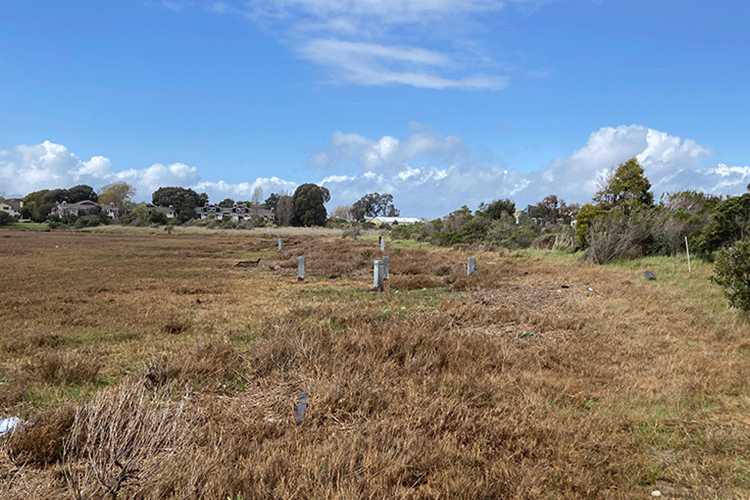
Remediating contaminated coastal sites can also create new habitat for humans and other animals. At UC Berkeley’s Richmond Field Station, a parcel of waterfront land once heavily polluted with mercury and other contaminants has been restored to marshland, where the Ridgway’s Rail, a near-endangered species of bird, now lives and breeds.
“I think the vision needs to be about how to help communities stay in place as long as possible, especially low-income communities, because the social capital, the person-to-person networks, are very hard to replace or replicate,” Hill said. “And when we’re ready to transition to a more innovative kind of architecture or urban district that’s ready for high water, then we need to put the capital in and figure out how to do that in a way that helps everyone stay.”